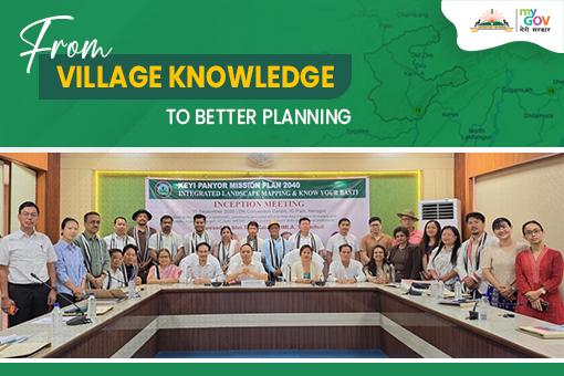
Recently, Keyi Panyor district initiated an integrated landscape mapping and “Know Your Basti” process under the Keyi Panyor Mission Plan 2040 (KPMP 2040), bringing scientific data and community knowledge together for long-term development planning.
The initiative will map land, water, forests, biodiversity, agriculture, livelihoods, settlements, climate risks and public services. Local youth will also be engaged as “ecosystem stewards”, helping document household experiences, elders’ knowledge, customary practices and local environmental observations.
Join the Discussion on MyGov Arunachal Pradesh:
1. Should every village in Arunachal Pradesh have a locally maintained knowledge base covering its land, water, biodiversity, livelihoods and public services?
2. What role can local youth play as “ecosystem stewards” in documenting and monitoring their communities?
3. Can community-led mapping help Arunachal plan more sustainably for the future?






Andaluri Srinivas 1 hour 7 min ago
Ground(real) statistical data must be validated and updated at data.gov.in